


Laser Imaging, Detection, and Ranging (LIDAR) is an investigative optical technique for measuring the velocity, location, or chemical concentration of a target. LIDAR achieves this by transmitting laser light to the target and analysing the reflected light that returns to the source. By scanning the light over large areas and distances, LIDAR can be used to obtain the surface features of solid objects, wind velocity, and atmospheric concentrations of gases.
There are several types of LIDAR. They include Doppler (coherent) LIDAR, direct detection LIDAR, and differential absorption LIDAR.
Doppler (coherent) LIDAR
Doppler LIDAR is used to measure the velocity of a target. When transmitted light reflects off a target moving towards or away from the source, the frequency of the reflected light is Doppler-shifted. The reflected light has a larger (“blue-shifted”) frequency if the target is moving towards the source, and smaller (“red-shifted”) frequency if the target is moving away from the source. The relationship between the Doppler shift and the velocity of the target relative to the source is approximately
|
∆f = |
∆v
|
fL |
| c |
where fL is the transmitted LIDAR frequency, Δf is the difference in frequency between the transmitted and received light, Δv is the velocity of the target relative to the source, and c is the speed of light.
Direct detection LIDAR
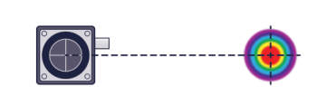
Direct detection LIDAR is used to determine the distance to a target relative to the source by transmitting a series of laser pulses at recorded times. When the pulses strike the target, some are reflected and return to the source. Each returning pulse is detected and the optical travel time (“time-of-flight”) is calculated, inferring the distance to the target.
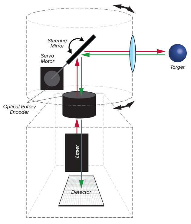
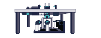
Direct detection LIDAR is used to measure the distance to a surface using an emitter, photodetector, and steering mirror. The steering mirror, coupled with a motor and rotary encoder, is used to scan an area to obtain the distance at many points. The emitter and detector are coupled to a PC equipped with a high-precision clock for recording the emission and detection times.
Differential absorption LIDAR
Differential absorption LIDAR is used to measure the chemical concentration of a target, typically a gas present in the atmosphere.
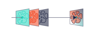
The molecule of interest absorbs incident light within a characteristic wavelength range (“absorption spectrum”). Therefore, two different laser wavelengths are transmitted to the target: one wavelength is highly absorbed by the molecule of interest whilst the other wavelength is not.
The ratio of the intensity of the two reflected wavelengths is then measured, and the amount of absorption by the molecule of interest is determined. The concentration of the molecule of interest in the target can then be calculated.
Applications
Wind velocity
Wind velocity can be measured using Doppler LIDAR. Laser light is transmitted and scanned across the atmosphere. Micron-sized particles carried by the wind then reflect the light back to the source. The Doppler shift of the reflected light is measured, and then the velocity of the particles travelling in the wind is calculated.
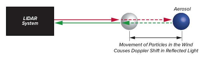
The wind carries microscopic particles (“aerosols”). A laser is transmitted into the atmosphere, and the aerosols reflect some light back to the source. The Doppler shift of the reflected light is used to calculate the velocity of the aerosols, and by inference, the velocity of the wind.
Topography
Topography is the arrangement of surface features of an area or object. Direct detection LIDAR can be used to measure the distance to a surface at many points. This data is then reconstructed to generate a topographic map.
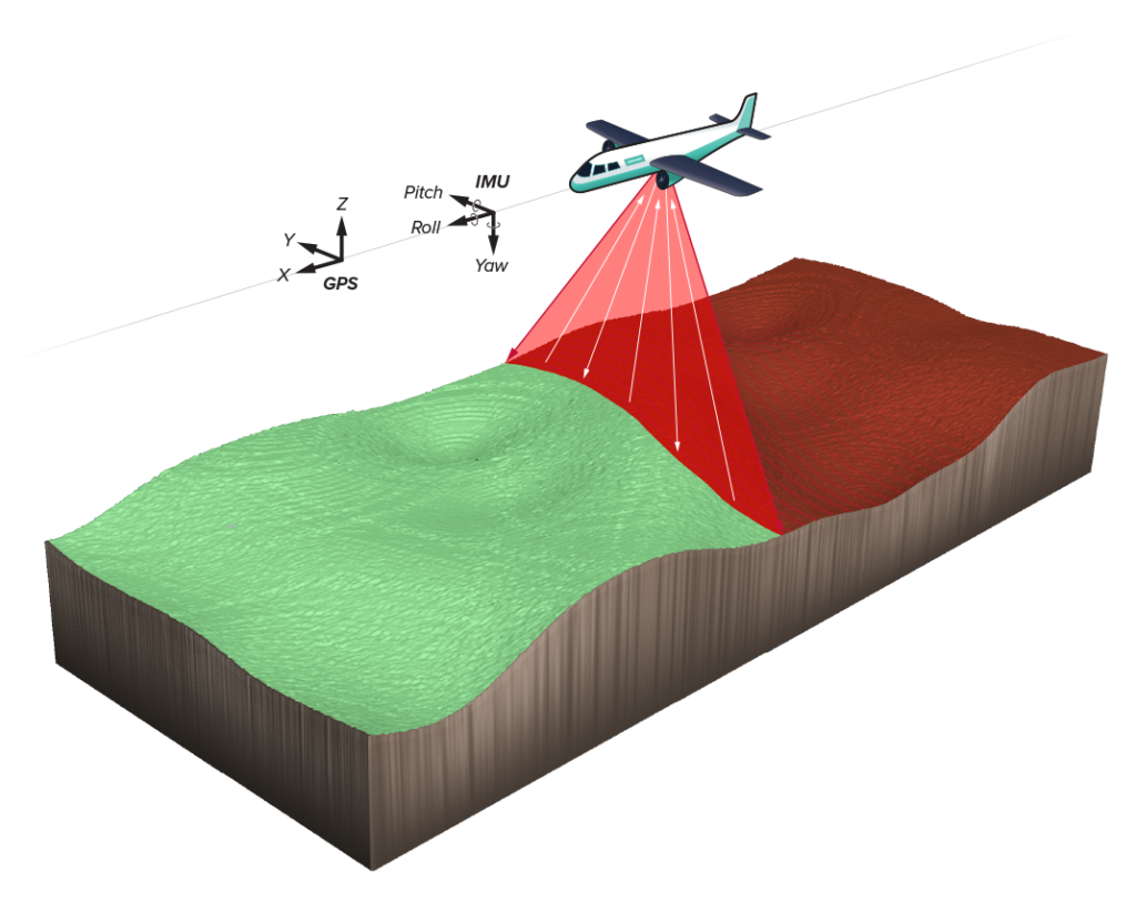
Aerial LIDAR instruments can be used to measure the topography over large area. The LIDAR instrument is used in combination with a Global Positioning System (GPS) that records the three-dimensional position of the scanner to provide a reference location per return pulse. An inertial measurement unit (IMU) is also used to determine the angular orientation of the scanner relative to ground.
Gas plume measurement
A gas plume is a column of one gas moving through another. The gas plume typically rises above a heat source because thermal expansion makes warm gas less dense than the surrounding cooler gas. Differential absorption LIDAR is commonly used to identify the materials present in a gas plume and measure the chemical concentrations. Doppler LIDAR can also be used to measure the velocity of gas plumes. In this way, the dispersion of air pollution, burning smoke, or toxic gas can be modelled and their chemical constituents identified.